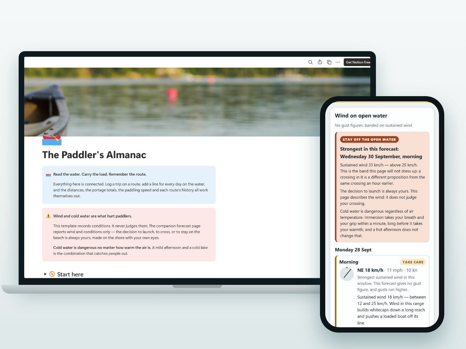
It reports conditions. The decision is always yours.
The decision to launch is always the paddler's. The wind page describes what the forecast says
the air is doing. It knows nothing about your boat, your load, your skills, who is with you, the fetch
of the water you mean to cross, or how far it is to a shore you could reach — so it will not tell you
to go, and it will not tell you to stay. “Calm” describes the wind, not your plan.
Cold water is dangerous regardless of air temperature. Immersion takes your breath and your grip
within a minute, long before it takes your warmth. Neither the template nor the page carries a water
temperature, because the forecast does not provide one and a guessed figure would be read as a
measurement.
Personal flotation devices, required equipment and where you may put in are set by your own
jurisdiction, and differ from one water to the next. Nothing here states any of them, and nothing here
encodes a rule about when to paddle. Read and follow what applies where you paddle.
Three bands, and only three
The put-in page leads with the wind: calm under 12 km/h, take care from 12 to 25 km/h, and
above 25 km/h stay off the open water. Both numbers are printed on the page rather than hidden
inside a score, morning and evening for every day in the forecast, with the direction the wind blows
from. Three bands rather than a yes or a no, because a yes would be a promise nobody can make.
The strongest wind, not the average day
Each window is banded on the strongest wind in it, never on a daily average that hides a hard
afternoon. The page names the figure it used, every time. On Canadian water the forecast carries no
gust figure, so the band comes from sustained wind and the page says so — gusts run higher than it,
and a missing gust is never read as a calm one.
Put-ins, portages and takeouts
Every route with its put-in and takeout, its portages and their lengths, the parking, the permits you
needed and the notes you only learn by having been there. One tap from a route opens the wind page for
its put-in. The coordinates live in your own Notion and in that page's address, and nowhere else.
Days on the water that add up
Log each day when you get home: distance, hours, the wind you actually got, who was with you and how
the boat handled loaded. The template totals your kilometres by season and by boat, and after a couple
of years you are reading your own water rather than anyone's average.
How much light is left
Sunrise, sunset and the length of the day for the put-in, with whether the days are lengthening or
shortening, so a crossing that looked fine on the map is checked against the hours that are actually
in it. Air temperature and rain sit beside them for the same reason.
Private by design
Your routes, put-ins and logs stay on your device and in your own Notion. The wind page has no
accounts, no tracking and no analytics, and it never stores or logs a coordinate: they go to MET Norway
for the forecast and to Esri for the map tiles, and nowhere else. The page is noindex and
sends no referrer, so a put-in link cannot turn up in a search engine or leak through a click.
Questions
Does it tell me whether to go out?
No, and it is built not to. It tells you what the forecast says the wind is doing, in three bands you
can see the thresholds for. Whether a given crossing is a good idea depends on your boat, your load,
your skills, the people with you, the fetch and shape of the water, how far a swim to shore would be
and how cold that water is — none of which is in a weather forecast. The decision is always yours, and
a page that pretended otherwise would be worse than no page.
Why 12 km/h and 25 km/h?
Because they are round, defensible numbers that the page states openly rather than burying in a
score, and they sit either side of the range where a long reach starts throwing whitecaps and pushing a
loaded boat off its line. They are edges of a description, not a rule: 11 km/h is not permission and
26 km/h is not a prohibition. You can see the speed the band came from, and which figure it was taken
from, and judge for yourself.
Does it use gusts or average wind?
Neither, in practice — it uses the strongest sustained wind in each window, and names the figure it
used. Gusts would be better, because a gust is what capsizes people, but MET Norway publishes a gust
figure for its Nordic region only: on Canadian water there is none to read, so the page says so
rather than implying it has one. A missing gust is never treated as a calm one, and real gusts run
higher than the number you see.
Does it tell me the water temperature?
No. The forecast does not carry one, and there is no honest way to work it out from the air: a lake
lags the air by weeks, changes with depth and with the last storm, and a figure invented on this page
would be read as a measurement. What the page says instead is the part that is always true — cold water
is dangerous regardless of air temperature, and finding out how cold yours is, is your job.
What about PFDs, equipment and where I can launch?
Those are yours to check and follow. They are set by your own jurisdiction — country, province or
state, park, conservation authority, even the individual access point — and they change. The template
and the page deliberately state none of them: no equipment list presented as required, and no claim
that any particular launch is open to you. Find out what applies where you paddle, and record it in
your own copy.
Can I use it for navigation?
No. The map is for planning. Carry a chart or topo map and a compass, tell someone your plan, and
check local marine or lake forecasts and advisories on the day.
Do I need a paid Notion plan?
No. Everything in the template works on Notion's free plan.
Does it work in miles and knots?
Yes. Wind is shown in km/h, mph and knots side by side, temperatures in °C and °F, and rain in
millimetres and inches.
Where does the forecast come from?
From MET Norway's weather model for the put-in's coordinates, covering about the next 9 days. It is
model output for a point on a map: wind over open water runs stronger than the same wind over land, it
funnels between islands and down a long reach, and it has no idea which side of a headland you are on.
Will my put-ins stay private?
Yes. Routes, put-ins and logs live in your own Notion. The wind page keeps its coordinates in the page
address only: nothing is stored, nothing is logged, there is no analytics on the page, and the
coordinates go to exactly two places — MET Norway for the forecast, and Esri for the map tiles.
I'm stuck. How do I get help?
Send a message through Etsy and I'll help you sort it out.