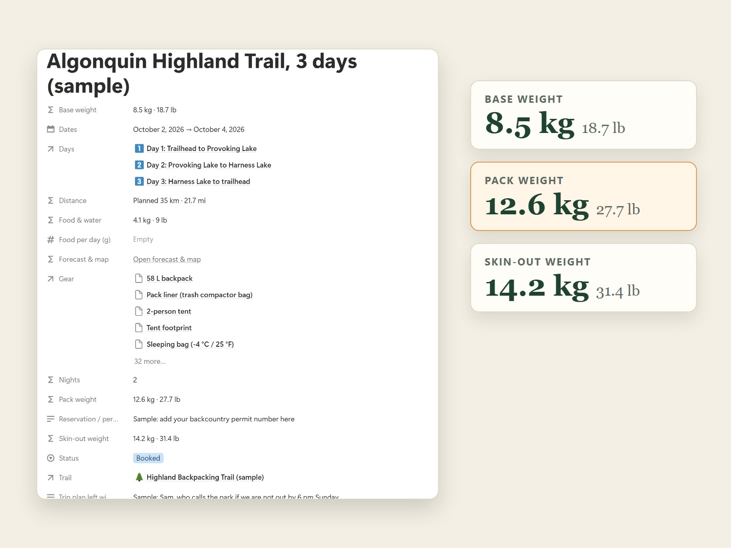
Tick your gear. The weights do the math.
Weigh each piece of gear once. Tick it onto a trip and the template works out your base weight, pack weight and skin-out weight, including food for every day and water by the litre, in kg and lb.
 Outdoor Almanacs
The Hiker's Almanac
Free forecast demo
Outdoor Almanacs
The Hiker's Almanac
Free forecast demo
Notion template · hiking & backpacking
A connected Notion workspace for hikers and backpackers. Pick a trail, tick the gear you're bringing, and your pack weight, distance and a live trailhead forecast work themselves out.
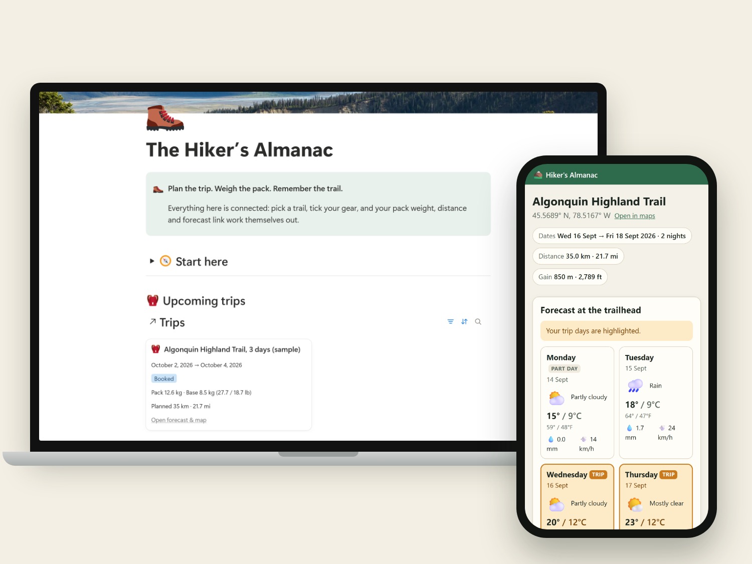
Weigh each piece of gear once. Tick it onto a trip and the template works out your base weight, pack weight and skin-out weight, including food for every day and water by the litre, in kg and lb.
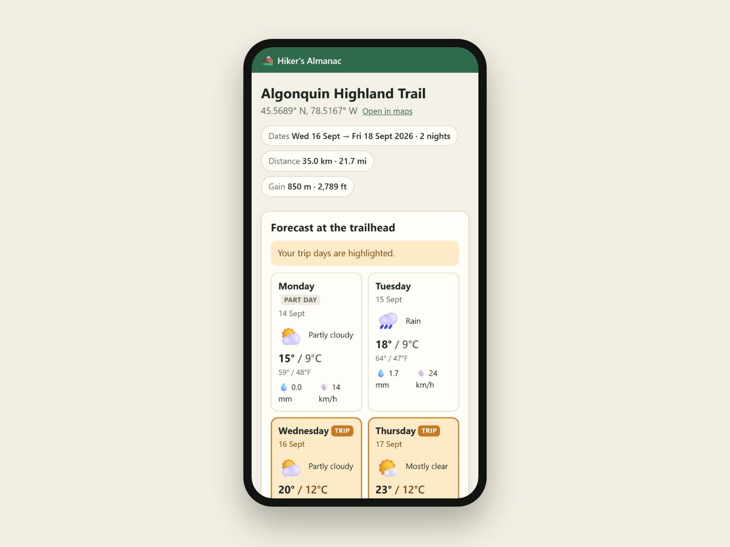
One tap from any trip opens this site with up to 9 days of forecast for the trailhead. Your trip days are highlighted, with highs and lows in °C and °F, rain and wind. No app to install, no account to create.
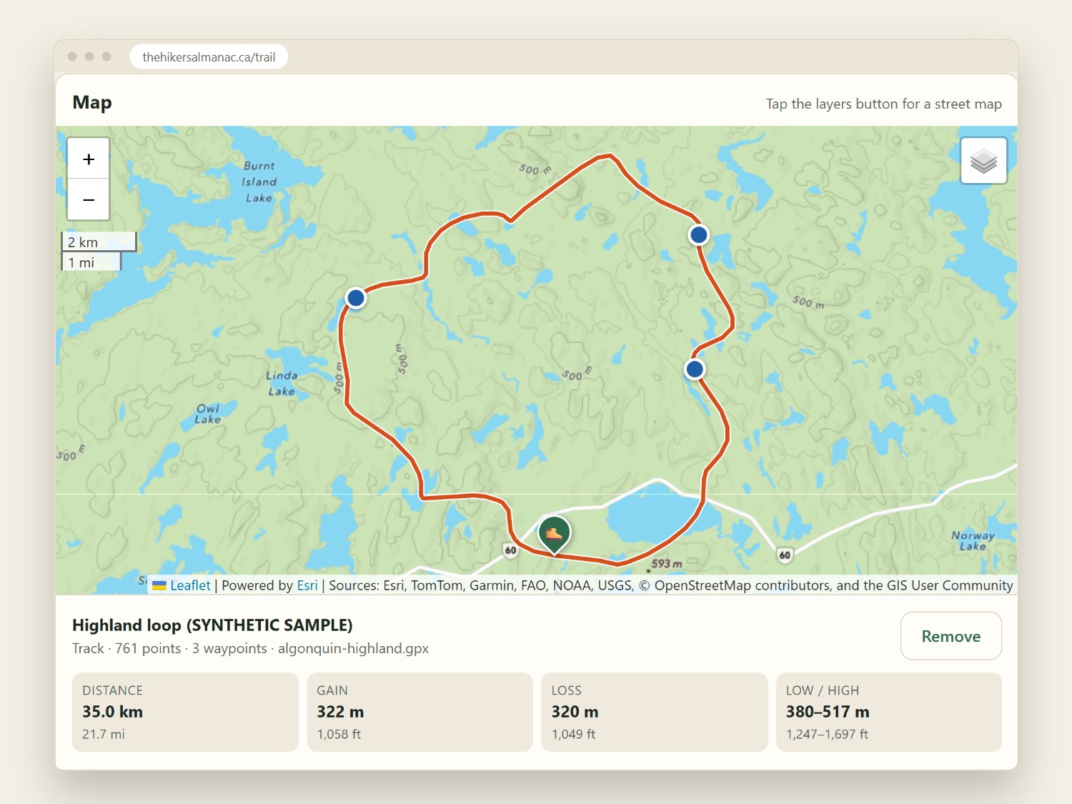
Drop in a GPX file from AllTrails, Gaia GPS, CalTopo or Garmin to see the route on a topo map, with distance, gain, loss and an elevation profile you can drag along. The file is read in your browser and never uploaded.
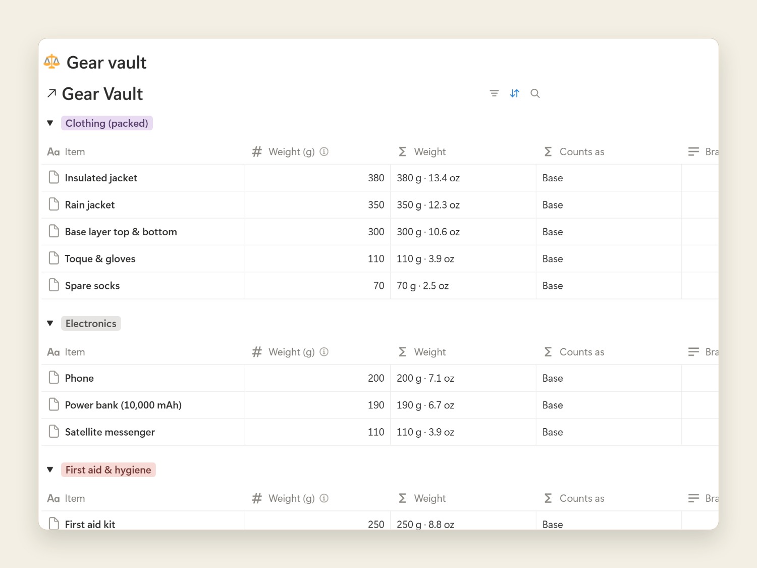
Keep every piece of gear in one list, grouped by category, and every trail on your bucket list sorted by difficulty, with permits, parking notes and links. Log each day when you get home, and watch your lifetime kilometres add up.
Free to try
This is the page the template opens for each trip: a live forecast for the trailhead and a topo map. On the page, tap Load the sample track to see a route and its elevation profile.
The sample trail and GPX are synthetic, for demonstration only, and not for navigation.
You'll need a free Notion account. The template works on the free Notion plan, on desktop, in a web browser and in the Notion phone app.
No. Everything in the template works on Notion's free plan.
Yes. You enter weights in grams, distances in kilometres and gain in metres, and every total is shown in both kg and lb, km and mi, and m and ft.
From MET Norway's weather model for the trailhead's coordinates. It opens up to about 9 days before a trip. Conditions on ridges and in valleys can differ, so always check local forecasts and park alerts before you go.
No. The map and elevation profile are for planning. Carry a map and compass, and a GPS app or device if you use one.
No. It's read by your browser on your own device. The page can remember your last file for each trail, and that copy also stays on your device.
Send a message through Etsy and I'll help you sort it out.